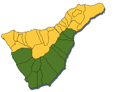
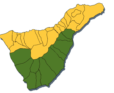
![](https://assets.zyrosite.com/cdn-cgi/image/format=auto,w=1920,fit=crop/YX412VbWKjHeZLV5/20220610_144806-A0xrWM7ZrXclKex3.jpg)
SOUTH
EXPLORING THE
Hikes 1 to 10
DISCOVER OUR HIKES IN THE SOUTH
The south of the island is known for its beautiful small sandy beaches found all along the coastline.
Its enviable climate and year-round sunshine ensure that the water is always warm enough for you to enjoy water sports and the wide range of leisure activities on offer.
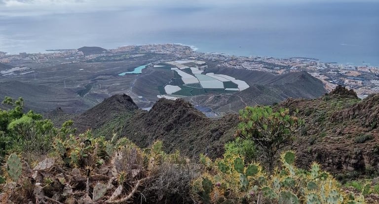
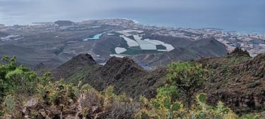
Hiking in South Tenerife's impressive landscapes, such as the many barranco's and rocks, but also the beautiful coastline are just some of the options the south offers.
![](https://assets.zyrosite.com/cdn-cgi/image/format=auto,w=263,h=208,fit=crop,trim=0;20.92391304347826;0;20.92391304347826/YX412VbWKjHeZLV5/zuid-mk359be0MQHqk8jM.png)
![](https://assets.zyrosite.com/cdn-cgi/image/format=auto,w=257,h=210,fit=crop,trim=0;32.526881720430104;0;32.526881720430104/YX412VbWKjHeZLV5/zuid-mk359be0MQHqk8jM.png)
8.6km
![](https://assets.zyrosite.com/cdn-cgi/image/format=auto,w=574,h=309,fit=crop/YX412VbWKjHeZLV5/linde-AQEVDlkykETj7DDV.jpg)
![](https://assets.zyrosite.com/cdn-cgi/image/format=auto,w=328,h=147,fit=crop/YX412VbWKjHeZLV5/linde-AQEVDlkykETj7DDV.jpg)
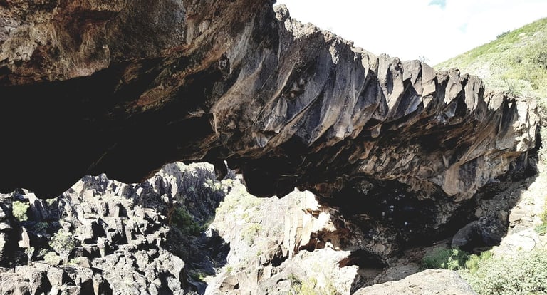
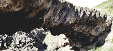
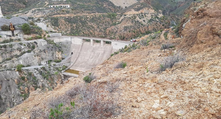
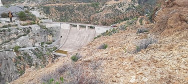
BARRANCO DE LA LINDE
![Total distance of this hike?](https://assets.zyrosite.com/cdn-cgi/image/format=auto,w=60,h=56,fit=crop/YX412VbWKjHeZLV5/dis-Yyv27Rze8JhN1P9w.jpg)
![Total distance of this hike?](https://assets.zyrosite.com/cdn-cgi/image/format=auto,w=53,h=51,fit=crop/YX412VbWKjHeZLV5/dis-Yyv27Rze8JhN1P9w.jpg)
In search of the hidden Arco De Jurado
![](https://assets.zyrosite.com/cdn-cgi/image/format=auto,w=60,h=56,fit=crop/YX412VbWKjHeZLV5/medium-A3Qr7jDV4Rhj5D67.jpg)
![](https://assets.zyrosite.com/cdn-cgi/image/format=auto,w=53,h=51,fit=crop/YX412VbWKjHeZLV5/medium-A3Qr7jDV4Rhj5D67.jpg)
![How many altimetres?](https://assets.zyrosite.com/cdn-cgi/image/format=auto,w=60,h=56,fit=crop/YX412VbWKjHeZLV5/alt-Yle5vEjMBKF915Ve.jpg)
![How many altimetres?](https://assets.zyrosite.com/cdn-cgi/image/format=auto,w=53,h=51,fit=crop/YX412VbWKjHeZLV5/alt-Yle5vEjMBKF915Ve.jpg)
234m
![Loop or not?](https://assets.zyrosite.com/cdn-cgi/image/format=auto,w=60,h=56,fit=crop/YX412VbWKjHeZLV5/loop-YrDXlPPpG7FnKlrz.jpg)
![Loop or not?](https://assets.zyrosite.com/cdn-cgi/image/format=auto,w=53,h=51,fit=crop/YX412VbWKjHeZLV5/loop-YrDXlPPpG7FnKlrz.jpg)
YES
![Not recommended for people with vertigo!](https://assets.zyrosite.com/cdn-cgi/image/format=auto,w=60,h=56,fit=crop/YX412VbWKjHeZLV5/ver-m2Wrpg6KP9iLB8gl.jpg)
![Not recommended for people with vertigo!](https://assets.zyrosite.com/cdn-cgi/image/format=auto,w=53,h=51,fit=crop/YX412VbWKjHeZLV5/ver-m2Wrpg6KP9iLB8gl.jpg)
NO
7.65km
![](https://assets.zyrosite.com/cdn-cgi/image/format=auto,w=574,h=309,fit=crop/YX412VbWKjHeZLV5/eras-dOqN8gO1NKFQx6Lx.jpg)
![](https://assets.zyrosite.com/cdn-cgi/image/format=auto,w=328,h=147,fit=crop/YX412VbWKjHeZLV5/eras-dOqN8gO1NKFQx6Lx.jpg)
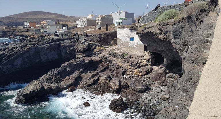
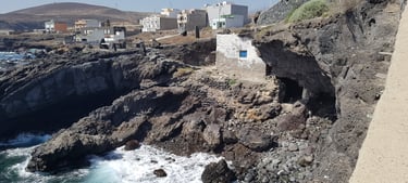
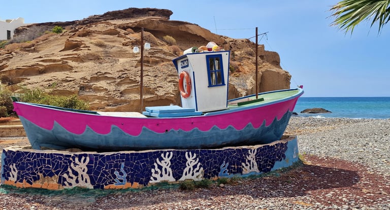
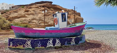
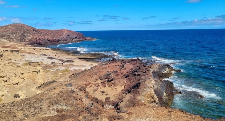
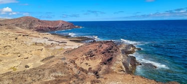
LAS ERAS ► PORIS DE ABONA
![Total distance of this hike?](https://assets.zyrosite.com/cdn-cgi/image/format=auto,w=60,h=56,fit=crop/YX412VbWKjHeZLV5/dis-Yyv27Rze8JhN1P9w.jpg)
![Total distance of this hike?](https://assets.zyrosite.com/cdn-cgi/image/format=auto,w=53,h=51,fit=crop/YX412VbWKjHeZLV5/dis-Yyv27Rze8JhN1P9w.jpg)
Unprecedented coastline in the south
![](https://assets.zyrosite.com/cdn-cgi/image/format=auto,w=60,h=56,fit=crop/YX412VbWKjHeZLV5/easy-ALpbP5xBo3cQG7qN.jpg)
![](https://assets.zyrosite.com/cdn-cgi/image/format=auto,w=53,h=51,fit=crop/YX412VbWKjHeZLV5/easy-ALpbP5xBo3cQG7qN.jpg)
![How many altimetres?](https://assets.zyrosite.com/cdn-cgi/image/format=auto,w=60,h=56,fit=crop/YX412VbWKjHeZLV5/alt-Yle5vEjMBKF915Ve.jpg)
![How many altimetres?](https://assets.zyrosite.com/cdn-cgi/image/format=auto,w=53,h=51,fit=crop/YX412VbWKjHeZLV5/alt-Yle5vEjMBKF915Ve.jpg)
115m
![Loop or not?](https://assets.zyrosite.com/cdn-cgi/image/format=auto,w=60,h=56,fit=crop/YX412VbWKjHeZLV5/loop-YrDXlPPpG7FnKlrz.jpg)
![Loop or not?](https://assets.zyrosite.com/cdn-cgi/image/format=auto,w=53,h=51,fit=crop/YX412VbWKjHeZLV5/loop-YrDXlPPpG7FnKlrz.jpg)
NO
![Not recommended for people with vertigo!](https://assets.zyrosite.com/cdn-cgi/image/format=auto,w=60,h=56,fit=crop/YX412VbWKjHeZLV5/ver-m2Wrpg6KP9iLB8gl.jpg)
![Not recommended for people with vertigo!](https://assets.zyrosite.com/cdn-cgi/image/format=auto,w=53,h=51,fit=crop/YX412VbWKjHeZLV5/ver-m2Wrpg6KP9iLB8gl.jpg)
NO
10.5km
![](https://assets.zyrosite.com/cdn-cgi/image/format=auto,w=574,h=309,fit=crop/YX412VbWKjHeZLV5/boca-m7Vk5XjKyauyKavL.jpg)
![](https://assets.zyrosite.com/cdn-cgi/image/format=auto,w=328,h=147,fit=crop/YX412VbWKjHeZLV5/boca-m7Vk5XjKyauyKavL.jpg)
MIRADOR MONTAÑA BOCINEGRO
![Total distance of this hike?](https://assets.zyrosite.com/cdn-cgi/image/format=auto,w=60,h=56,fit=crop/YX412VbWKjHeZLV5/dis-Yyv27Rze8JhN1P9w.jpg)
![Total distance of this hike?](https://assets.zyrosite.com/cdn-cgi/image/format=auto,w=53,h=51,fit=crop/YX412VbWKjHeZLV5/dis-Yyv27Rze8JhN1P9w.jpg)
The little brother of Montaña Roja
![How many altimetres?](https://assets.zyrosite.com/cdn-cgi/image/format=auto,w=60,h=56,fit=crop/YX412VbWKjHeZLV5/alt-Yle5vEjMBKF915Ve.jpg)
![How many altimetres?](https://assets.zyrosite.com/cdn-cgi/image/format=auto,w=53,h=51,fit=crop/YX412VbWKjHeZLV5/alt-Yle5vEjMBKF915Ve.jpg)
117m
![Loop or not?](https://assets.zyrosite.com/cdn-cgi/image/format=auto,w=60,h=56,fit=crop/YX412VbWKjHeZLV5/loop-YrDXlPPpG7FnKlrz.jpg)
![Loop or not?](https://assets.zyrosite.com/cdn-cgi/image/format=auto,w=53,h=51,fit=crop/YX412VbWKjHeZLV5/loop-YrDXlPPpG7FnKlrz.jpg)
YES
![Not recommended for people with vertigo!](https://assets.zyrosite.com/cdn-cgi/image/format=auto,w=60,h=56,fit=crop/YX412VbWKjHeZLV5/ver-m2Wrpg6KP9iLB8gl.jpg)
![Not recommended for people with vertigo!](https://assets.zyrosite.com/cdn-cgi/image/format=auto,w=53,h=51,fit=crop/YX412VbWKjHeZLV5/ver-m2Wrpg6KP9iLB8gl.jpg)
NO
![](https://assets.zyrosite.com/cdn-cgi/image/format=auto,w=60,h=56,fit=crop/YX412VbWKjHeZLV5/easy-ALpbP5xBo3cQG7qN.jpg)
![](https://assets.zyrosite.com/cdn-cgi/image/format=auto,w=53,h=51,fit=crop/YX412VbWKjHeZLV5/easy-ALpbP5xBo3cQG7qN.jpg)
8km
![](https://assets.zyrosite.com/cdn-cgi/image/format=auto,w=574,h=309,fit=crop/YX412VbWKjHeZLV5/lv-mk35z76jy3TNMwjl.jpg)
![](https://assets.zyrosite.com/cdn-cgi/image/format=auto,w=328,h=147,fit=crop/YX412VbWKjHeZLV5/lv-mk35z76jy3TNMwjl.jpg)
LAS VEGAS
![Total distance of this hike?](https://assets.zyrosite.com/cdn-cgi/image/format=auto,w=60,h=56,fit=crop/YX412VbWKjHeZLV5/dis-Yyv27Rze8JhN1P9w.jpg)
![Total distance of this hike?](https://assets.zyrosite.com/cdn-cgi/image/format=auto,w=53,h=51,fit=crop/YX412VbWKjHeZLV5/dis-Yyv27Rze8JhN1P9w.jpg)
Past the traditional architecture of southern Tenerife
![](https://assets.zyrosite.com/cdn-cgi/image/format=auto,w=60,h=56,fit=crop/YX412VbWKjHeZLV5/easy-ALpbP5xBo3cQG7qN.jpg)
![](https://assets.zyrosite.com/cdn-cgi/image/format=auto,w=53,h=51,fit=crop/YX412VbWKjHeZLV5/easy-ALpbP5xBo3cQG7qN.jpg)
![How many altimetres?](https://assets.zyrosite.com/cdn-cgi/image/format=auto,w=60,h=56,fit=crop/YX412VbWKjHeZLV5/alt-Yle5vEjMBKF915Ve.jpg)
![How many altimetres?](https://assets.zyrosite.com/cdn-cgi/image/format=auto,w=53,h=51,fit=crop/YX412VbWKjHeZLV5/alt-Yle5vEjMBKF915Ve.jpg)
320m
![Loop or not?](https://assets.zyrosite.com/cdn-cgi/image/format=auto,w=60,h=56,fit=crop/YX412VbWKjHeZLV5/loop-YrDXlPPpG7FnKlrz.jpg)
![Loop or not?](https://assets.zyrosite.com/cdn-cgi/image/format=auto,w=53,h=51,fit=crop/YX412VbWKjHeZLV5/loop-YrDXlPPpG7FnKlrz.jpg)
YES
![Not recommended for people with vertigo!](https://assets.zyrosite.com/cdn-cgi/image/format=auto,w=60,h=56,fit=crop/YX412VbWKjHeZLV5/ver-m2Wrpg6KP9iLB8gl.jpg)
![Not recommended for people with vertigo!](https://assets.zyrosite.com/cdn-cgi/image/format=auto,w=53,h=51,fit=crop/YX412VbWKjHeZLV5/ver-m2Wrpg6KP9iLB8gl.jpg)
NO
LIST ALL OUR HIKES IN THE SOUTH
If you want an instant overview of all our hikes in the south , check our Wikiloc page for more information and GPX-files.
IPB INDEX
What is it?
![](https://assets.zyrosite.com/cdn-cgi/image/format=auto,w=812,h=256,fit=crop/YX412VbWKjHeZLV5/tabla_dificultad_en-YNqrxj9N3ZtJyBZo.jpg)
![](https://assets.zyrosite.com/cdn-cgi/image/format=auto,w=328,h=264,fit=crop/YX412VbWKjHeZLV5/tabla_dificultad_en-YNqrxj9N3ZtJyBZo.jpg)
What kind of trail is it?
The IBP index is an algorithm that analyses the difficulty of a mountain or road bike route or a running trail generating a precise number.
Our index will help you to compare the difficulty of different trails.
The measure of the difficulty of a route is different from the effort it requires: a route with an IBP index of 60 will be very hard for a debutant, a pretty normal one for someone with an average preparation, and very comfortable for a professional cyclist (see comparative chart).